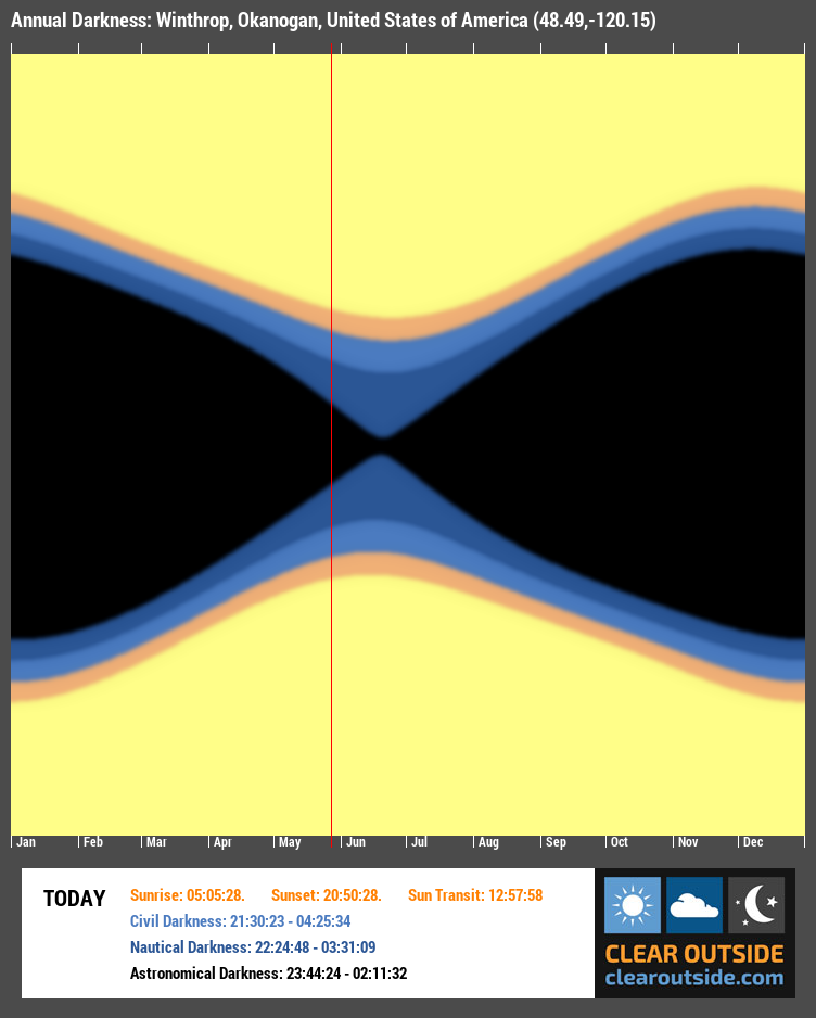
Annual Darkness for Winthrop, Okanogan, United States of America (48.49,-120.15)
See how the sun’s rise/set times for your location change over the course of a year. Shows civil, nautical and astronomical darkness.
Refreshes hourly. Daylight saving time is not shown.
Note: Clear Outside does not store or display your precise location. The embedded forecast links to a full forecast which includes a latitude and longitude rounded to two decimal places and a general location description of a nearby area, e.g. a road name or district.

Embed Annual Darkness Image
To embed the chart in your own website or blog please copy and paste the code below:
For forums, please copy and paste the bbcode below:

